Your cart is empty
Your cart is currently empty. Let us assist you in finding the right product.

Tracking Systems
The UAV Tracker System is a high-performance autonomous antenna tracking solution designed for reliable long-range communication with unmanned aerial vehicles. Using advanced GNSS and RF-based tracking algorithms, the system provides precise real-time antenna positioning to maintain optimal communication links with moving aerial platforms.
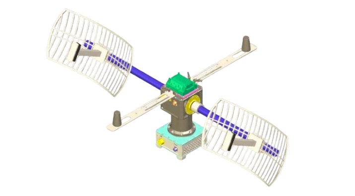
| The UAV Tracker System is a high-performance autonomous antenna tracking solution designed for reliable long-range communication with unmanned aerial vehicles. Using advanced GNSS and RF-based tracking algorithms, the system provides precise real-time antenna positioning to maintain optimal communication links with moving aerial platforms. |
| Pan Axis Range 360° Continuous (Slip Ring) | Pan Axis Speed 30°/Second | Tilt Axis Range ±90° (180° Total) |
| Tilt Axis Speed 30°/Second | Radio Interface Ethernet, RS232, RS485 | Feedback Absolute Encoder |
| Encoder Accuracy 0.1° | Alignment Automatic GNSS Based | Leveling Inclinometer |
| GPS Receiver Onboard GNSS Receiver | Tracking GPS Based / RSSI RF Signal Based | Payload Capacity 20 Kg |
| Antenna Gain 24 dBi | RF Connector TNC Female | Controller Windows Tablet GUI |
| Power 48V DC 6A | Temperature -20°C to +60°C | Weight 10 Kg |
| Mounting Mast / Tripod |
High-precision GNSS RTK Base/Rover Receiver designed for mining, surveying, asset tracking, vehicle navigation, and industrial positioning applications. The system delivers centimetre-level accuracy using RTK correction data and integrated long-range radio communication.
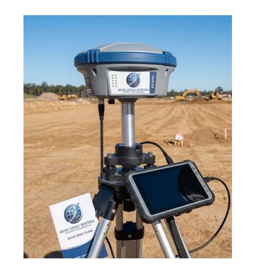
| High-precision GNSS RTK Base/Rover Receiver designed for mining, surveying, asset tracking, vehicle navigation, and industrial positioning applications. The system delivers centimetre-level accuracy using RTK correction data and integrated long-range radio communication. |
| Supported Constellations GPS, GLONASS, Galileo, BeiDou, QZSS | RTK Horizontal Accuracy ±1 cm + 1 ppm | RTK Vertical Accuracy ±2 cm + 1 ppm |
| Single Point Accuracy < 1.5 m CEP | Initialization Time < 10 Seconds | Update Rate Up to 10 Hz |
| Frequency Range 400–470 MHz | Data Rate Up to 19.2 kbps | Communication Range Up to 3 Km |
| Channels 1400+ | Power Consumption < 3 W | Voltage 9–24 V DC |
| Protection IP67 | Temperature -20°C to +65°C | Weight < 500 g |
Buy ₹100 more to get free shipping
Your cart is currently empty. Let us assist you in finding the right product.